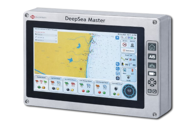
RT-DSM-NAV01
Navigation Display Unit
Marine-grade touchscreen console running the full DeepSea Master HMI — charts, AIS, alerts and onboard controls.
Empowering fishermen and marine fleets with intelligent vessel monitoring, AI analytics, emergency alerts, and real-time communication.
Seven integrated capability domains — from life-saving safety systems to AI-driven optimization — unified in one platform.
Protect every crew member with always-on safety intelligence.
Precision positioning and tracking across open water.
Predictive marine weather and sea-state awareness.
Real-time vessel vitals and predictive maintenance.
Resilient connectivity from coast to deep sea.
A unified cloud, web and mobile command center.
Intelligence that anticipates risk and optimizes operations.
Purpose-built hardware and software for vessel monitoring, bridge control and maritime communication — engineered by Rax-Tech International.
Marine-grade touchscreen console running the full DeepSea Master HMI — charts, AIS, alerts and onboard controls.
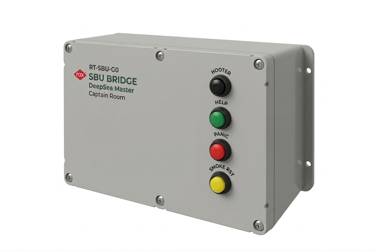
Ruggedized bridge unit with Hooter, Help, Panic and Emergency controls, wiring rooms and sensors into the network.
Onboard console delivering real-time vessel monitoring, telemetry and control from a single marine-grade interface.
Integrated bridge automation for navigation, propulsion and vessel control with intuitive operator dashboards.
GPS positioning, route management and passage planning for safe, efficient voyages across open water.
Resilient satellite connectivity keeping vessels online far beyond cellular range in deep-sea operations.
Secure cloud ingestion, analytics and reporting that turn fleet telemetry into operational intelligence.
Live vessel tracking with SOS, geo-fencing and safety-alert devices for rapid emergency response.
Onboard sensor suite capturing weather, sea-state and engine data for predictive marine insight.
Centralized command for entire fleets — status, routing, compliance and historical reporting in one place.
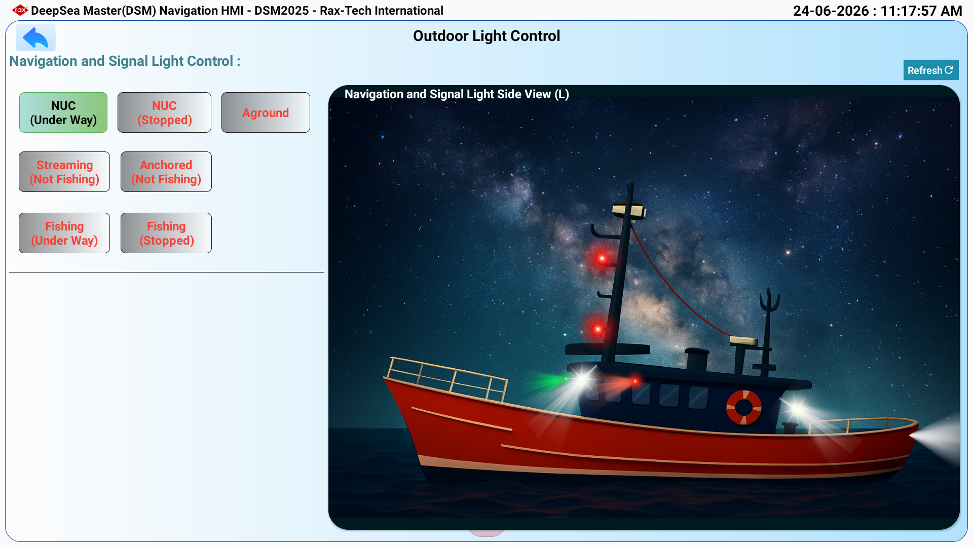
Real screens from the onboard navigation console — purpose-built for clarity, safety and split-second decisions at sea.
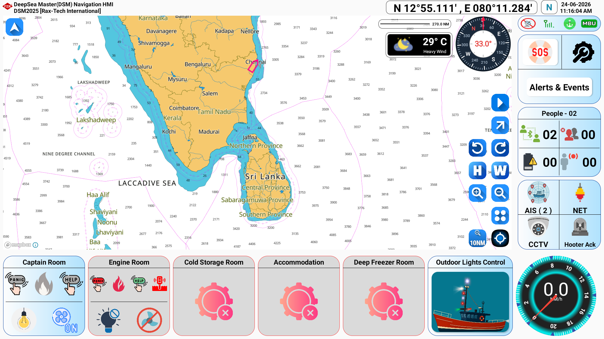
Live ENC chart, GPS position, weather, compass, speed and one-touch room controls on the RT-DSM-NAV01 console.
DeepSea Master unifies marine IoT sensors, AI analytics and secure cloud infrastructure into a single safety-first system — giving operators complete, real-time visibility from shore to open ocean.
Powering DeepSea Master's mapping engine with trusted, professional-grade marine charts used by mariners worldwide.
DeepSea Master partners with C-MAP — a global leader in marine cartography — to bring industry-trusted charts, bathymetry and navigation data directly into your fleet dashboard. Every vessel position is plotted on the same professional-grade charts mariners rely on at sea.
Official C-MAP marine cartography rendered natively inside every DeepSea Master map.
Detailed seabed data and depth shading for safer navigation in shallow and coastal waters.
Live tidal predictions, currents and points of interest layered over your fleet view.
Worldwide chart coverage kept current with regular C-MAP data updates.
Every signal flows securely through eight intelligent layers, in real time, from the deck of the boat to government oversight.
GPS, engine, fuel, weather and SOS sensors capture onboard data.
Edge gateway aggregates, buffers and securely transmits telemetry.
Dual connectivity keeps vessels online across all waters.
Scalable services ingest, process and store data securely.
Real-time visualization, analytics and fleet-wide alerts.
Critical insights and alerts on the go, on any device.
Teams act on insight to keep crews safe and fleets efficient.
Compliance, safety oversight and rapid emergency coordination.
Device Communication Network
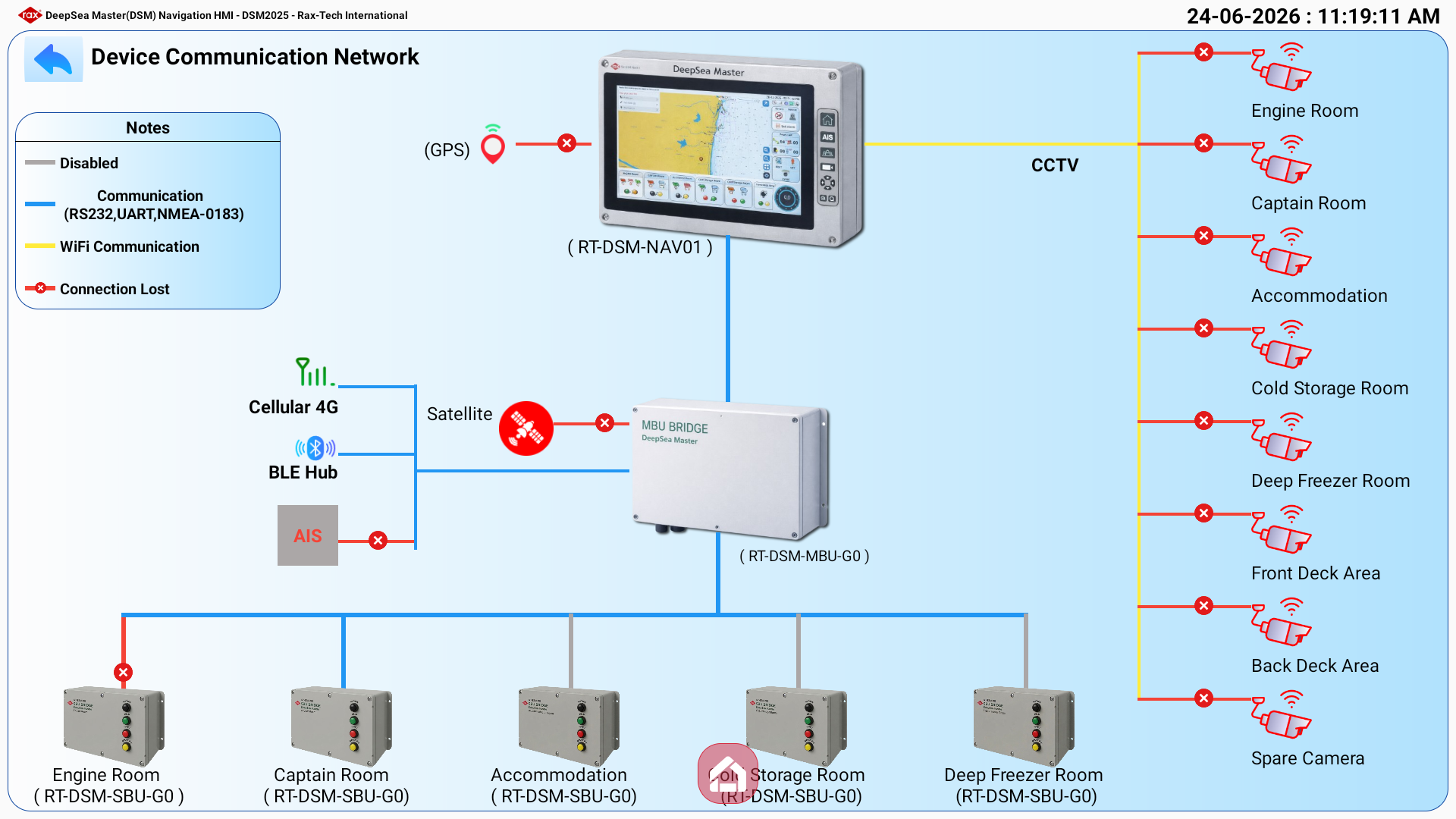
A real DeepSea Master deployment — the RT-DSM-NAV01 console and RT-DSM-MBU gateway connect room-level SBU sensor units, GPS, AIS, CCTV and satellite / 4G links into one network.
Real-time telemetry, environmental intelligence and emergency events — visualized with clarity worthy of mission control.
Liters / hour · last 8h
12 kn
NE24°
Partly cloudy
19.4°C
Stable8 / 8
All crew accounted for
Trips completed · last 12 weeks
One platform, many missions — DeepSea Master adapts to the needs of every operator on the water.
Safer trips, optimized voyages and protected crews.
Centralized command for commercial fleets at scale.
Reliable data and connectivity for scientific missions.
Faster search-and-rescue with live positions.
Monitor assets and crews in remote operations.
Oversee harbor traffic, arrivals and compliance.
Safety monitoring for high-risk offshore sites.
Smart monitoring for marine farms and pens.
Safety and efficiency gains that protect crews, reduce costs and keep your fleet running at its best.
Instant SOS, location sharing and rapid response.
Data-driven decisions across the entire fleet.
Optimized routes and consumption insights.
Detect anomalies before costly failures.
Anticipate storms with predictive intelligence.
Eyes on every vessel from shore, day and night.
Balance workloads and maximize uptime.
Meet maritime safety and reporting standards.
Hear from the captains, fleet managers and rescue teams who rely on DeepSea Master every day.
“DeepSea Master gave us complete visibility over our fleet. When a boat lost engine power offshore, the SOS alert reached us in seconds — it genuinely saved lives.”
Captain Arjun Menon
Fleet Operations, Coastal Fisheries Co.
“The AI weather intelligence transformed how we plan trips. We've cut fuel costs and avoided two major storms this season thanks to early warnings.”
Maria Santos
Director, Atlantic Marine Logistics
“Setup was effortless and the dashboard is the clearest we've used. Our coast guard team relies on it daily for real-time positions and rapid response.”
Lt. David Okafor
Maritime Rescue Coordinator
Join the operators safeguarding crews and fleets with real-time intelligence. See DeepSea Master in action today.